01/30/2025 ICW Day 30 : A Current Affair
For example, if you are 6 miles South of an inlet, and your highest tide at your position happens at 9AM, you would THINK that the current also turns around at 9AM… but that isn’t exactly how it works. The water has a sort of inertia, kind of like pushing on a string. A bolus of water is still flowing in - even after the highest tide - even though the water doesn’t rise higher, the flow is still inbound. The same delayed reaction happens on the opposite end.
When you have power (either through pedal, sail, or motor), you can potentially overcome a certain degree of current. In our situation today, though, the speed of the current matched our pedaling ability of about 4mph. We don’t have a motor, and the wind was very light and straight on the nose.
Since we had so little brawn, we had to scrape by on what little brain power we had.
We did a short jaunt from our camp to the nearby park. Janet walked in search of a closed coffee shop while I attended to rudder repair. The sun felt great, and this killed enough time that I could see the boats anchored by their bow just barely starting to turn 180 degrees - in our favor.
The problem was that once we reached the inlet, a favorable current would suddenly be unfavorable as a river of water flowed the opposite direction once we passed the inlet.
We experienced a few shallows as the water went away. I coerced Janet into taking an extended lunch break to wait out the flow. I promised her we would be flying along at 5MPH if we waited until 3:30 PM.
We had an enjoyable lunch and then walked to explore the nearby trails and lighthouse. It was fun. But when we got back to the boat, the river of water was still against us, albeit not as strongly.
I know the water will turn eventually… but now we were jeopardizing the opportunity of finishing before dark. We got in and pedaled, also trying to make the most of a few wisps of wind that drove us towards the planned campsite.
I really enjoy the science and planning of it all. I just wish that nature worked better with the typical diurnal mammals sleep/wake schedule. We landed just before dark. Our routine and teamwork has improved over the past month, so we got our camp set up as efficiently as ever. The good news is that tomorrow, we have power from the South. That means we can make a big leap through a section that is mostly houses again - into a more natural section. Also, there are constrictions in the waterway, and the next inlet isn’t for 48 miles. I predict that this means softening currents and less dramatic tidal ranges (so there won’t be long portages from boat to camp). There is so much to think about each day, it is quite stimulating for the mind.
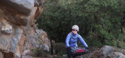
Photos:


Strava Comments:
Janet W.
Jesse B.
Osman I.
Corrine L.
Brian L.
Osman I.
Osman I.
Osman I.
Ride Stats:
| Elapsed Time | Moving Time | Distance | Average Speed | Max Speed | Elevation Gain | Calories Burned |
|---|---|---|---|---|---|---|
|
09:07:40
hours
|
05:17:00
hours
|
23.32
km
|
4.41
km/h
|
11.06
km/h
|
39.00
meters
|
1,112
kcal
|
You may also like...


Type 1 Diabetes Blog
-

When is a carb not a carb? The great fructose experiment.
August 4, 2023
-
-
My Type 1 Diabetes Diagnosis Story
May 31, 2021
-
-
Type 1 Diabetes FAQs – What food do you miss the most?
November 12, 2018
-
Type 1 Diabetes FAQs – You Can’t Eat That, Right?
November 3, 2018
-
Symlin for use in Type 1 Diabetes
October 30, 2018
-
-
-
-
-
-
-


-
August 22, 2017
-
-
August 23, 2015
-
-
Ionian Basin Traverse and Tehipite Gorge
July 17, 2015
-
-
Type 1 Diabetes FAQs – What food do you miss the most?
November 12, 2018
-
Leor’s Devils Falls and Hellhole Falls Loop
May 16, 2015


Highlights
-
February 9, 2024
-
Utah Bikepacking – All The Routes
September 30, 2021
-
Bikepacking Death Valley – Valle de la Muerte
February 12, 2021
-
Wandering the West Bikepack trip
October 23, 2020
-
October 10, 2019
-
October 9, 2018
-
January 12, 2018
-
December 8, 2015


