Leor’s Devils Falls and Hellhole Falls Loop
After last weekend at Canogas Falls, Leor carefully studied the satellite imagery and he discovered several previously unreported waterfalls. The official approach to Canogas Falls is only open one day per year, and that was last week. Canogas falls is on public, National Forest property, but the standard way of getting to Canogas requires going through Big Creek Preserve, which is private property, and can only be visited on their open house or with special permission. His route avoided the private property, so Leor’s new route is a fully legal access to Canogas (and other falls). Here you can find Leor’s account of this journey and Route that he designed. Below, I account the journey with some details about the challenges and vistas that you might encounter.
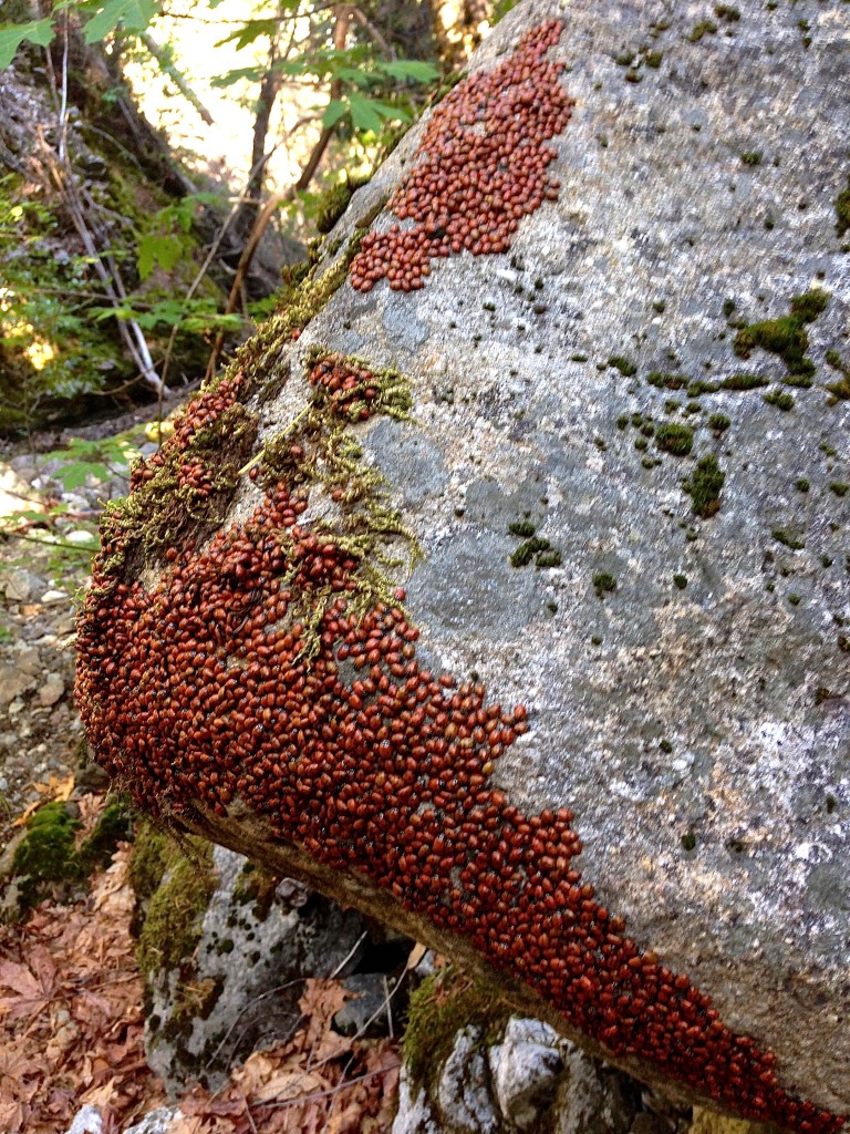
I was a little surprised to see these clusters of ladybugs EVERYWHERE on the Middle Fork of Devil’s Canyon. I’d seen clusters like this in February, and though they were over-wintering… but this is May. My only theory is that it had been 32F this morning, and perhaps they were gathering for warmth?
After looking at the satellite pictures, I knew I HAD to join him in spite of my groin injury. Sure enough, when we arrived at the first big falls, Leor was right: he had found a real gem via satellite! I think he’s going to name them “Devil’s falls.”
There are 3 cascades, the lower 2 are the biggest and most magnificent.
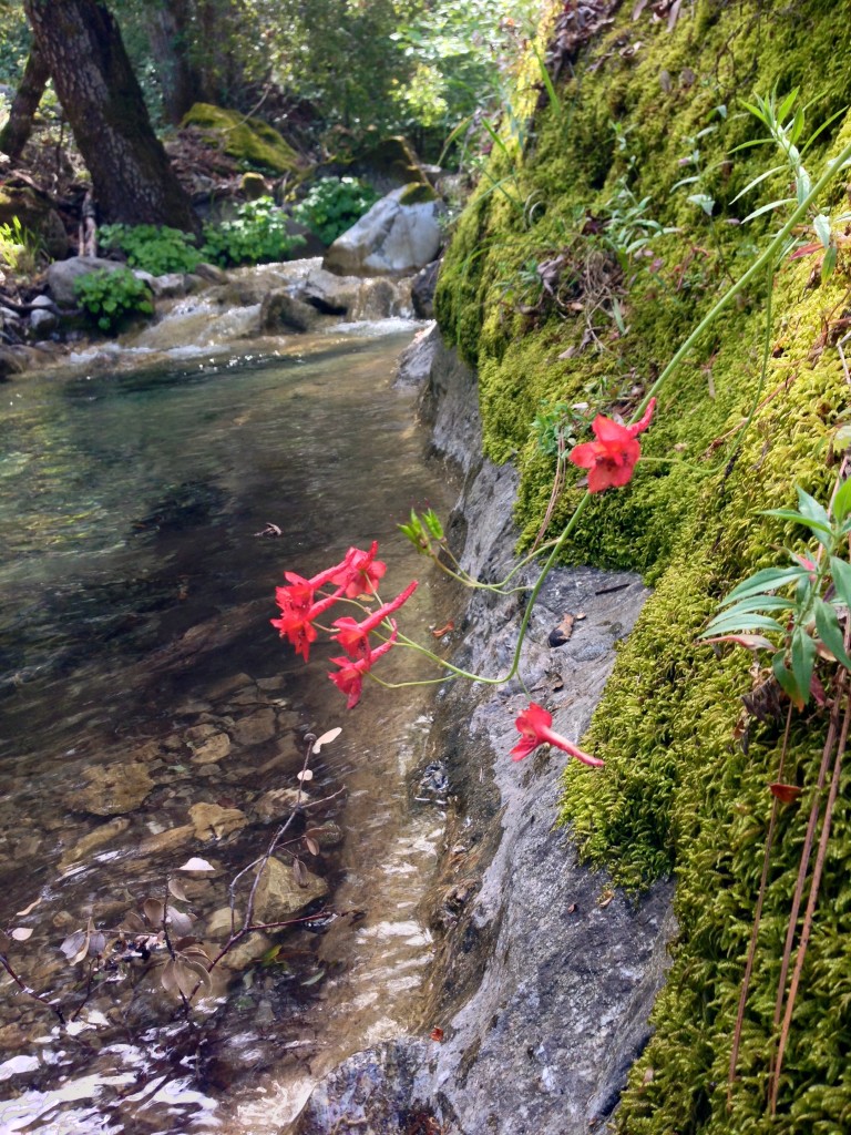
As we dropped into the Middle Fork of Devil’s Canyon, we could hear birds chirping everywhere. It was very unusual the concentration of bird music – I had never noticed so much song in the wild. Although we didn’t see any, these flowers would suggest the presence of hummingbirds.
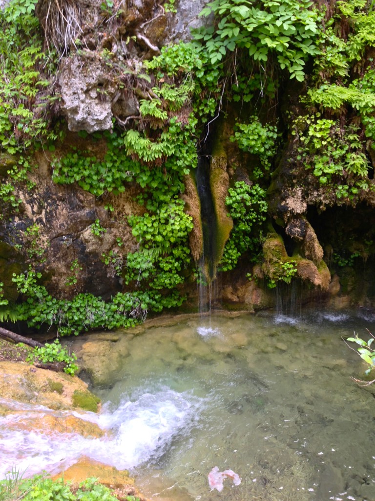
Little did we know, we were just getting started with waterfalls. This falls emerged from the rock. As you can see, there is this hard material that forms that seems to be unique to this drainage. It reminds me of coral, and I wondered if it is alive. Leor suggested it might be a mineral deposit.
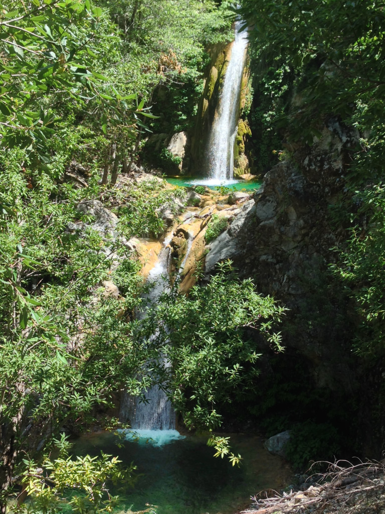
After our trip to Canogas Falls last weekend, Leor started studying the satellite images of the Middle Fork of Devil’s Canyon. In doing so, he discovered what he though might be some waterfalls. Sure enough, the satellite imagery came through big time!! Leor has most likely decided to name these “Devil’s falls.”
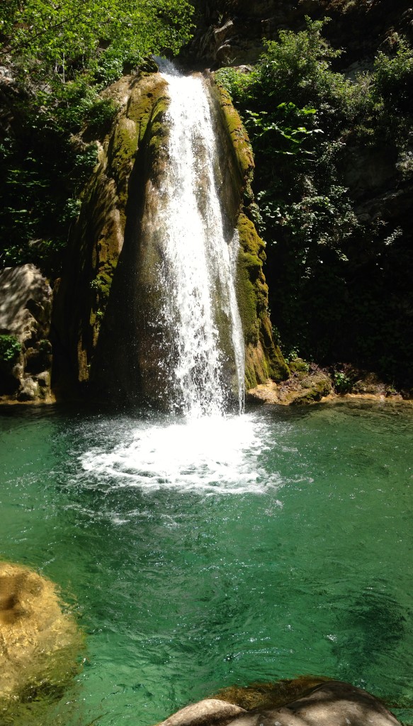
This location looks like Hawaii – and if it were 15 degrees warmer, I’m sure it would feel like paradise! We did not swim, although the perfectly shaped pools were tempting us.
We reveled in the beauty of these falls for a long time, but we knew we needed to get out of there. We debated turning back or making the full (much longer) loop. Eventually we flipped a digital coin, and it said to turn back. Leor said, “man!” I said, “sounds like you wanted to keep going…” So, we ventured off into the unknown – worrying that at any point we could encounter a cliff/waterfall that would be too big to scale, and we’d have to turn back – perhaps late in the day). We kept going down Middle Fork, and it was as pleasant as creek walking can be. At the confluence of South and Middle, we headed up South Fork, and immediately things changed. It was quite a bit steeper, and we were frequently greeted with waterfalls. This would have been great, but we had to get back on a trail before sunset. After passing Canogas falls (the falls from last week), we kept climbing, encountering difficult falls after difficult falls. Suddenly, I saw something… “We’re F****ed!” I exclaimed! Leor thought I was joking until he saw the cliff that was spitting water through a notch. It was a super looking falls, so we got up close for a look and pictures – but we knew that we would have to go around it or turn back (turning back now would mean doing hours of off trail travel in the dark; getting to the cars by maybe 2am). The terrain was very steep on the walls of the canyon, and we were worried that we were running out of time. We climbed the delicate, loose rock, finally making it to easier terrain.
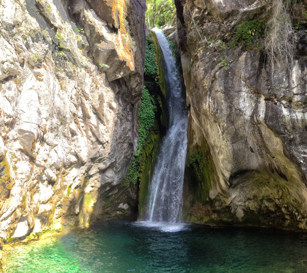
Leor refered to this as “Hellhole Falls” so that is how I labeled it on my map (map is last picture). This falls may already have a real name, as Leor’s sharp eye (and mind) noticed that a thumbnail of it appears on the Big Creek Reserve Web Page.
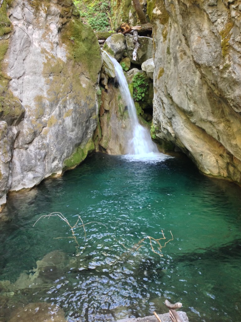
This falls is called “Suprise Falls” on my map. The reason I named it that is because we had had a nice long stretch of smooth sailing, and then we encountered this final obstruction that we had to climb around. By now, South Fork had decidedly earned the term “relentless” in our minds.
The relentless South Fork hit us with just one more surprise falls that we had to climb around the long way. Eventually, we made it to some cleared trail. Even though it was a difficult trail, it felt so easy after all that climbing over rocks and blown down trees! At the springs, Leor went ahead, and we ran into the darkness with our headlamps. It was a genuinely epic day!
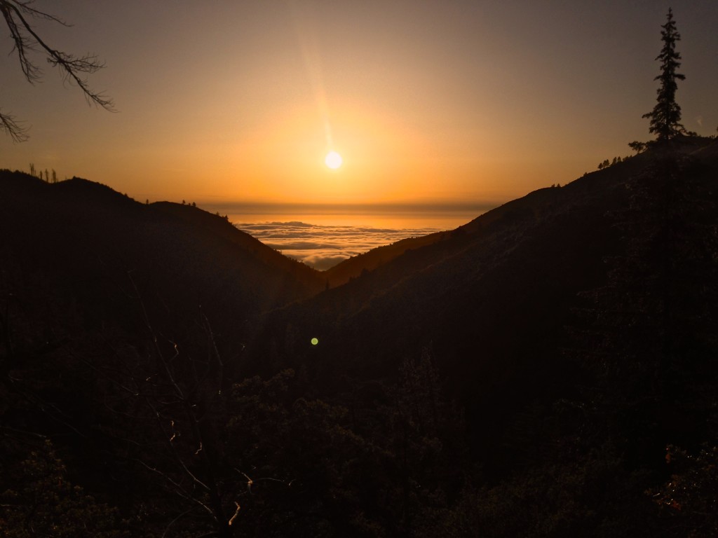
The obligatory sunset photo. That’s the South Fork of Devil’s Canyon in the foreground – the drainage we ascended.




Hi Brian. I can see the route from Middle Fork Devils Canyon to the falls, but how do you get to Middle Fork in the first place? I studied the boundaries of the Landels-Hill Big Creek Reserve and it seems they control most access points to the Middle Fork. Looking at bigsurtrailmap.net, the only other ways I see is either from Ojito camp (where you ended) or from the North Coast Ridge trail, going down North Fork creek for more than 3 miles. However, that would seem like a long way to reach Middle Fork! I’m a simple hiker, so for trail runners that might not seem long at all, I don’t know 🙂
I’d love if you sent me an email to let me know your entry point.
Thank you!
These trips are just amazing. I hope I can do this before I die.
Hi Brian. This was a great post and looks amazing! You mention there was a map of the route you took. Is that something you can share? Would love to do it.
Leor and I had a long discussion about the route, and he felt that it should remain somewhat occluded – so I removed the map from my site at his request. He opined that the reader could figure out how to get there from the text, and that is part of the experience. I tend to agree with him. This is a special place, and it would be a shame if too many people went there. By not disclosing a map, it increases the probability that only people who are truly passionate about discovering places in the outdoors will go.
I figured that was probably the case. Much appreciated Brian. I definitely agree it’s part of the experience. Me and my buddy have already started trying to map it out but since it’s a drive from where we live, we’d hate to mess it up. But hey, maybe it’s an excuse for us to visit multiple times. Love what you both are doing. Keep up the great work.