Bike Touring Colombia – Popayan to Mocoa via Purace
This route takes you from Popayan (“the white city”) across the spine of the Andes… Twice!
If you’ve ever heard of the term “FOMO,” you’ll know that I have it bad. “FOMO” stands for “Fear Of Missing Out.” FOMO has made me go visit extremely difficult places – just to make sure that there isn’t anything to miss.
Popayan to Purace
So, my case of FOMO had me studying the map, and I decided that just like Nevado de Ruiz, we were going to do a “thorough study” on the Purace National Park. We would ride up to 11,000′ on the North side, Climb the namesake Volcano, descend back to the bottom, and then climb back up again on the road that crosses the South side of the park. We consider Purace a must-see if you’re in Colombia and you like mountains and nature!
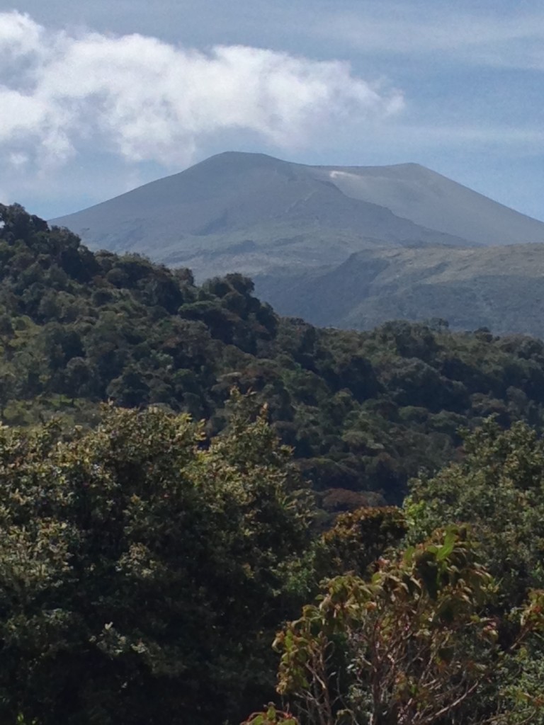
Purace summit. We wanted to climb it, but the peak was closed due to volcanic activity. Don’t worry – there are still A LOT of beautiful places to see in Purace!
When we got to the park office, we were kindly informed that the Purace Volcano is closed to hiking. Can you imagine the disappointment of climbing up thousands of feet on a dirt road to find out that your objective is forbidden? Fortunately, you’re reading this, so you won’t suffer the same disappointment.
It turns out that the park officials had plenty of fun in store for us. They have a map painted on the wall indicating all the amazing places you can go visit on a challenging, but fun bike ride. We were game!
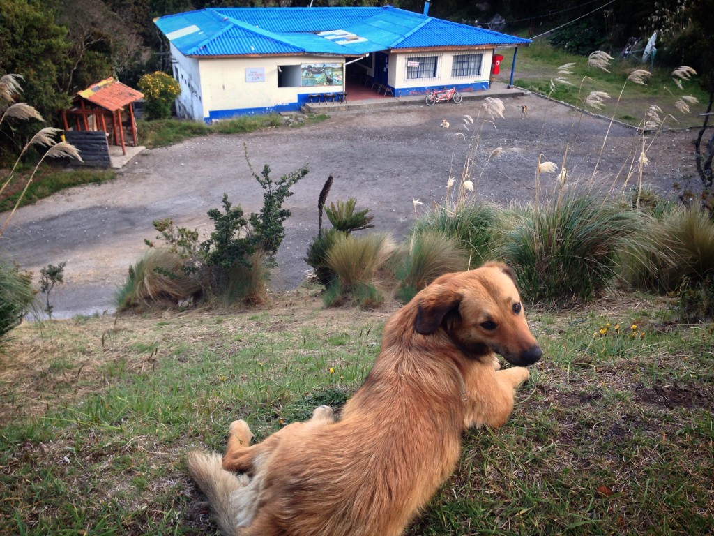
The reception center at Purace National Park. Here, they have WiFi (you have to pay a teenager 500 COP ($0.10 USD) and he enters some passwords into your phone). You can rent a double room in a dorm for 40,000COP per night, or you can get some rustic cozy cabins for a little more. All have fireplaces inside (we did not use ours, even though it was cold).
When we arrived at the park office, we were the only visitors. We had our choice of rooms – cabins, dorm style, or camping. There is a restaurant attached to the park office. Colombian National Parks are in the process of handing over responsibility for the parks to the local native populations. Because they are in transition, this may have resulted in a little bit of disorganization with regards to the accommodation. We were initially told that our room would be 10,000 COP per night, but later on, it increased to 40,000. The room was easily worth 30,000 ($10USD) compared to other places we’ve stayed in Colombia, so no biggie. As a side note, I felt that the people running the show were not quite used to accommodating tourists. They weren’t rude, but I didn’t feel welcome either. In the middle of the park, right where you enter the Termales San Juan, there is another ranger station (also with a restaurant across the road). The rangers there were extremely welcoming. I believe that you might be able to lodge there as well, and I’d recommend it.
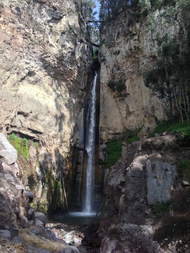
Chorrera de las Monjas Waterfall – a short walk from the school in Purace town. If you are on your way to the North side of the park, try not to miss this amazing fall! Follow our GPS track, or just ask around in town for the Chorrera de las Monjas. If you do not ask for it by name, people will assume you are looking for the more famous San Francisco Falls, which is higher up the mountain. This one is right near town, and much more captivating!
Purace National Park occupies the Paramo that flanks the volcano by the same name. The Paramo is characterized as land that sits over 3,200 Meters in the tropics with specific types of vegetation such as Frailejones. You can find Paramo in Colombia, Ecuador, Peru, and Costa Rica. The park is transected by two roads – one crosses the North end, and one crosses the South end. To travel both roads, you need to go several miles and descend thousands of feet out of the park. The center and namesake of the park is the Volcan Purace – a volcano that sits fuming not only from its cone, but also from various locations along the side.
If you decide to visit – in spite of the volcano’s closure – you still have a number of sites to visit – in this order from West to East:
1) The Condor Lookout
2) Laguna Andulbio
3) Valle de los Frailejones
4) Bedon Falls
5) Cristales
6) Termales San Juan
3) Cascada San Nicolas
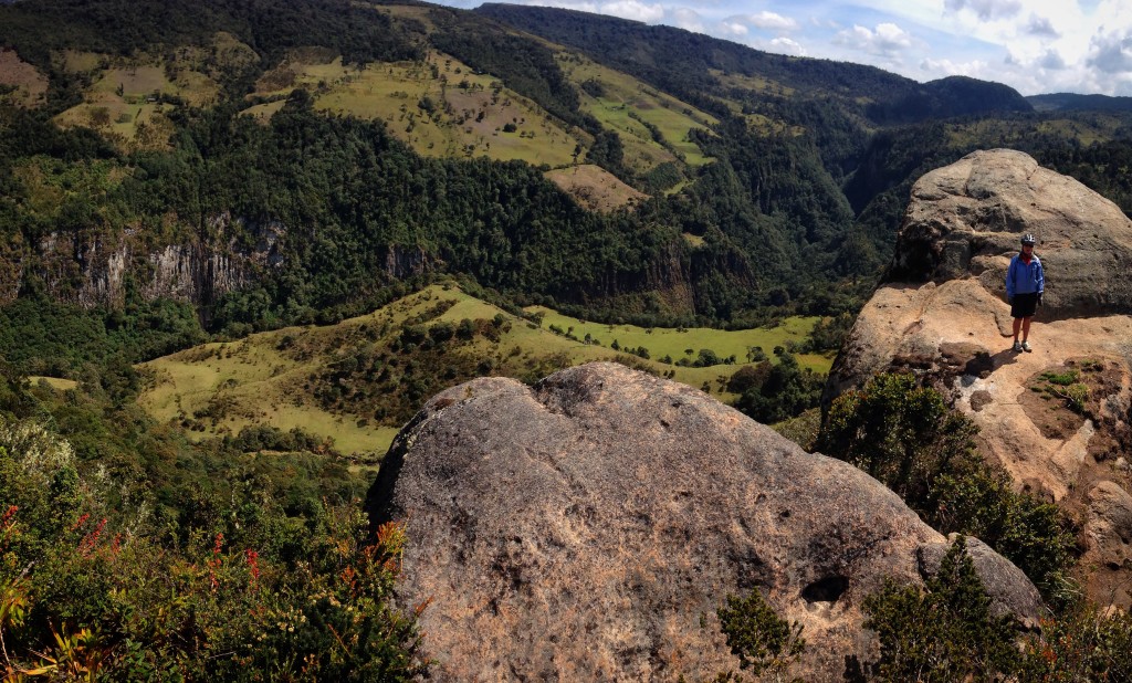
Janet standing at the Condor Lookout. We didn’t see any condors on this day, but we would come back later, and with the help of some carrion, we’d see them up close and personal!
Our first trip to the Condor lookout was just one of great scenery. You look across a great canyon with waterfalls on the other side. We learned that the trick is to tell the park rangers that you want to see some Condors. You can donate a little money for Condor food (putrid smelling carrion) which the rangers leave on a rock. Within an hour or so, the Condors will arrive. The Condors here were raised in the San Diego (California, United States) zoo – about 20 years ago. Twelve Condors were brought back from San Diego to try and get them to breed here. There are only 3 remaining; none of them ever bred. We got to see two of the remaining three. Although our iPhone pictures are of poor caliber, I highly recommend trying to see Condors up close in person. From a distance, or even in photos, these birds look… cool. But close enough, in real life, they will leave you floored.
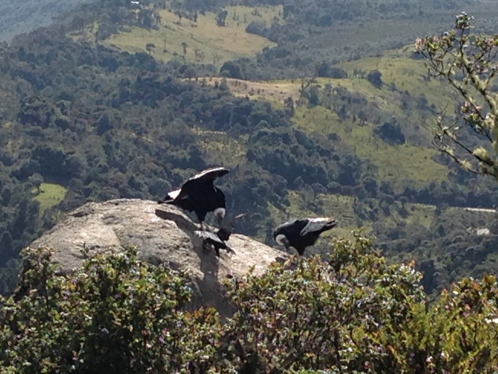
Janet captured the condors with her iPhone. You don’t realize how big these birds are until they get really close to you (or you see them next to a turkey vulture). One of them dropped a micro droplet of carrion on my jacket – and I stank the rest of the day!
An interesting thing about the Condors – they will wait for the turkey vultures to go for the rotting flesh first. It’s only after these scavengers spend a few minutes with the carrion that the Condors will use their mighty size to come in and finish things off.
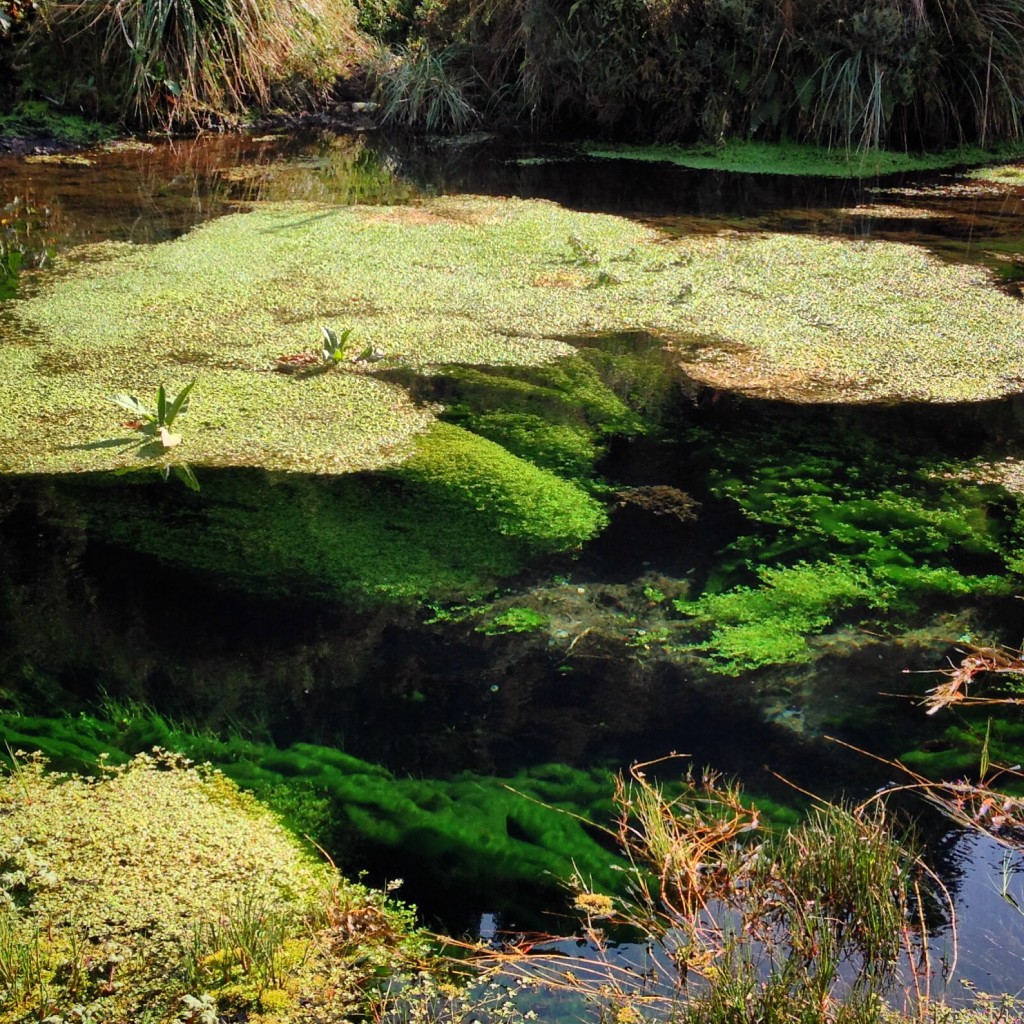
Cristales. This water is special because it is crystal clear – you can see straight down to the bottom. The park ranger told us that the big problem is contamination from people throwing coins in. This is right alongside the dirt road, so people have easier access.
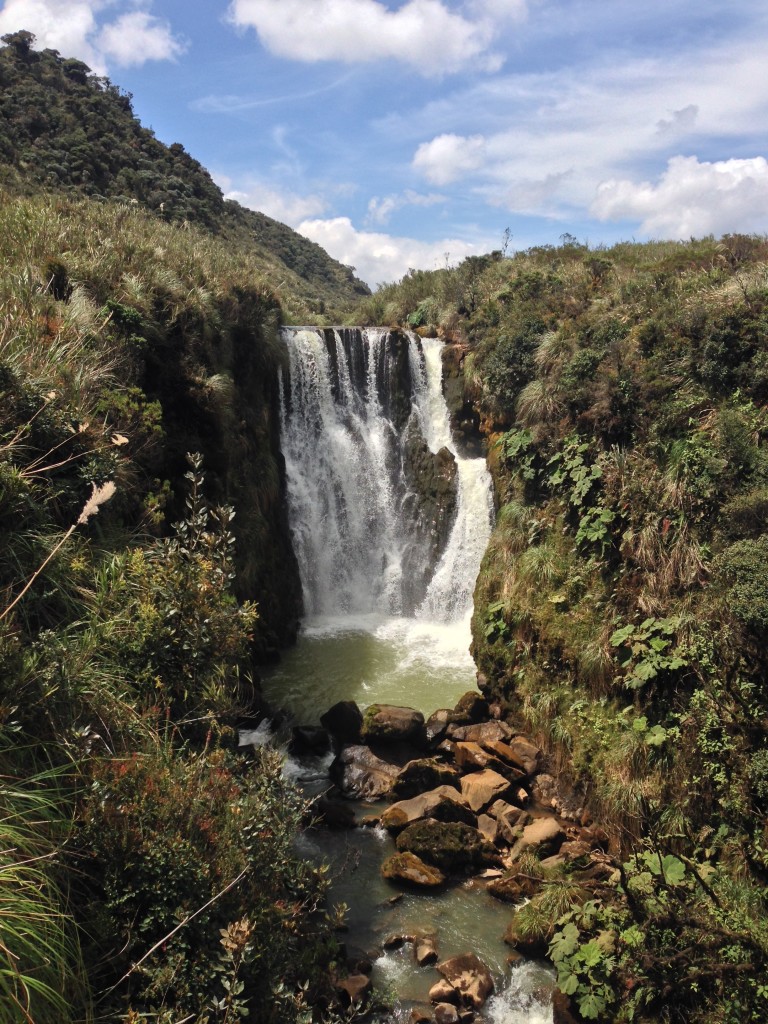
Bedon Falls, not far from the road. There is a good place to stand to take in these beautiful falls!
Further along the road, we visited Bedon Falls, and the amazing Termales San Juan. Termales San Juan washed away every bit of my disappointment in being unable to visit the Purace volcano… and you can’t even get into these hot springs; they’re just for viewing!
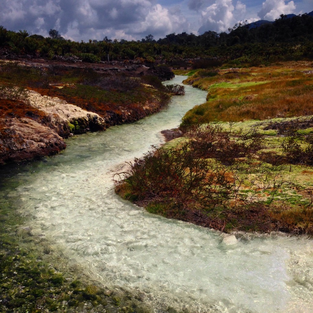
Termales San Juan – this is where the hot water meets the cold. Pictures are nice, but this place is amazing in person.
At the far North Eastern end of the park, there is one final attraction. If you’re not already waterfall-ed out, this one is definitely worth a visit: San Nicolas Falls.
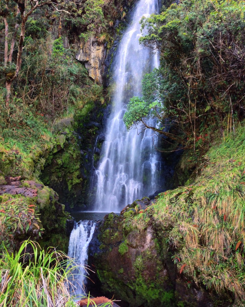
The beautiful San Nicolas falls. It’s a steep muddy hike to get here (even in the dry season). Nevertheless, they are stunning! They are the furthest point along in the park too – you have to ride your bike across the entire park to get here. Having done it, though, it’s definitely worth it if you have time.
Purace to San Agustin via Coconuco
We thoroughly enjoyed the North end of Purace. It turns out that there is not much infrastructure on the Southern end of the park, so if you don’t have FOMO, you’re going to want to prioritize the North end. We wanted to get to San Agustin, so we turned around and descended back to Coconucu to head back up the other side of the mountain. Before we headed up, though, there is still plenty to see near Coconuco.
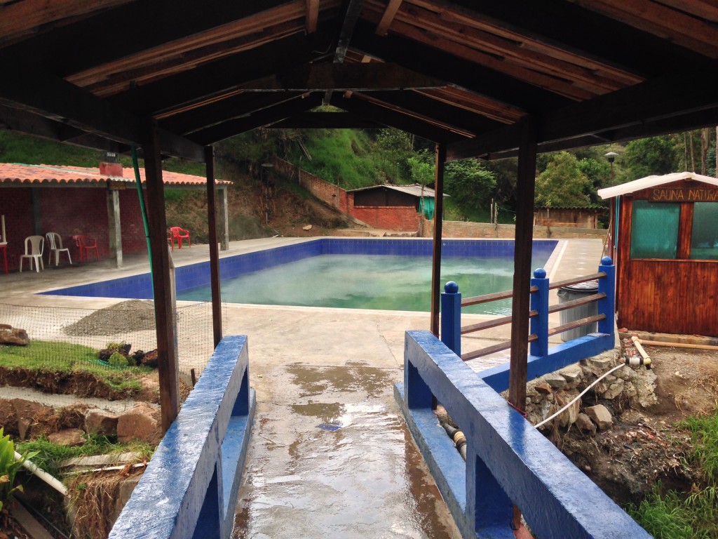
The hottest pool at Aguas Herviendos. This pool is too hot to realistically use. I managed to get in up to my ankle, and another guy got in momentarily to his waist – immediately running out saying that he was going to “boil his eggs.”
Coconuco is the home two two thermal hot springs. Both are for bathing; one is called “Aguas Herviendos” (boiling waters), and the other is called “Aguas Tibias” (lukewarm waters). We visited Aguas Herviendos, but we heard that Aguas Tibias is more expensive, and possibly more beautiful. You can lodge at or in-between Coconuco and either of these springs. We were pleased with our decision to lodge in the town of Coconuco at an establishment named “El Amigo que une a Los Amigos” (The friend that brings the friends together). Oddly, the name of this hotel is the same as the tag line on the national beer (this beer is named Poker). A basic room with no hot water, but extremely friendly staff for 15,000COP (double). After you visit either hot spring, it is all downhill back to your room!
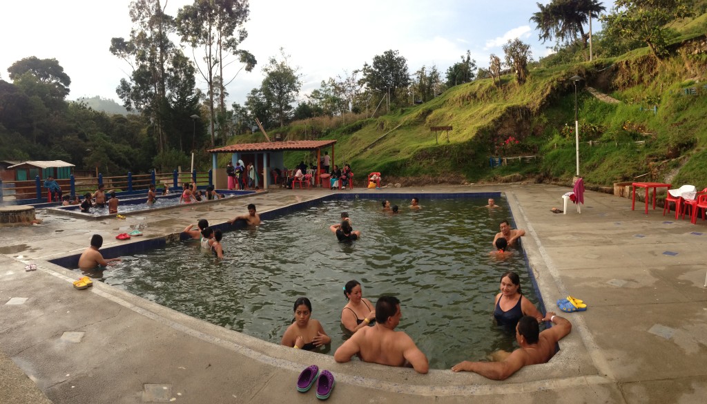
Aguas Herviendos. Entry is 7,000 COP per person. There is another hot spring further along the road (towards San Agustin from Coconuco). The other is called Aguas Tibias, and costs 15,000 COP to enter.
Leaving from Coconuco, back across the Andes, you will enter one of the more rugged regions of Colombia. This road is unpaved a few miles after Coconuco. There are steep, very rough sections, and it passes through jungle and cloud forest. The road varies between one and one-and-a-half lanes wide. Nevertheless, we’d periodically encounter large dump trucks abandoned in the middle of the road. Closer inspection revealed ripped off transmissions, broken axles, and stacks of wheels laid on their sides to support rear ends of vehicles – pools of various black liquids streaming down the dusty road.
It was along this road that we also encountered two Swiss Bicycle tourists. They were both riding high-quality bicycles – but similar to the trucks we had been seeing, they were having some problems. I asked them what was broken, hoping that we could help. Their response was, “everything.” I looked, and saw broken spokes twisted around neighboring spokes, disc brakes that broke, and other maladies. If you decide to traverse this route, you’re going to want something really sturdy – mountain bike tires and 26″ wheels.
Prior to arrival, we had heard of the San Agustin Archaeological park. So, we were surprised to find out that there is a huge complex of neighboring archaeological sites based out of Isnos! “Everyone goes to San Agustin, but no one visits these other parks,” said the hotel owner where we were staying in Isnos. So, my FOMO had me constructing a new route that visited many of the Isnos sites as well. In fact, the places we went were just as exciting (if not better) than San Agustin. Moreover, your 20,000COP entry fee to the Isnos sites also grants you entry into San Agustin, and it is valid for 3 days.
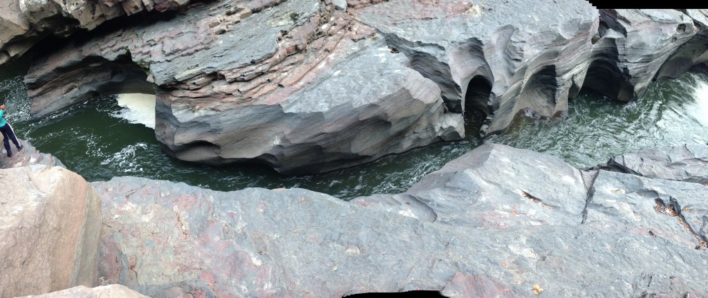
The Estrecho del Rio Magdalena. This is the point where the huge Rio Magdalena only becomes a few feet wide.
Our route included a visit to the Estrecho del Rio Magdalena. The Rio Magdalena is usually hundreds of feet wide, but in this location, it restricts to an area that you could literally jump across! If you decide to follow our cycle route, be warned: you end up directly crossing two river valleys. You drop in, climb out, drop in the other, and climb out. It’s unpaved and a 20% grade in every direction!
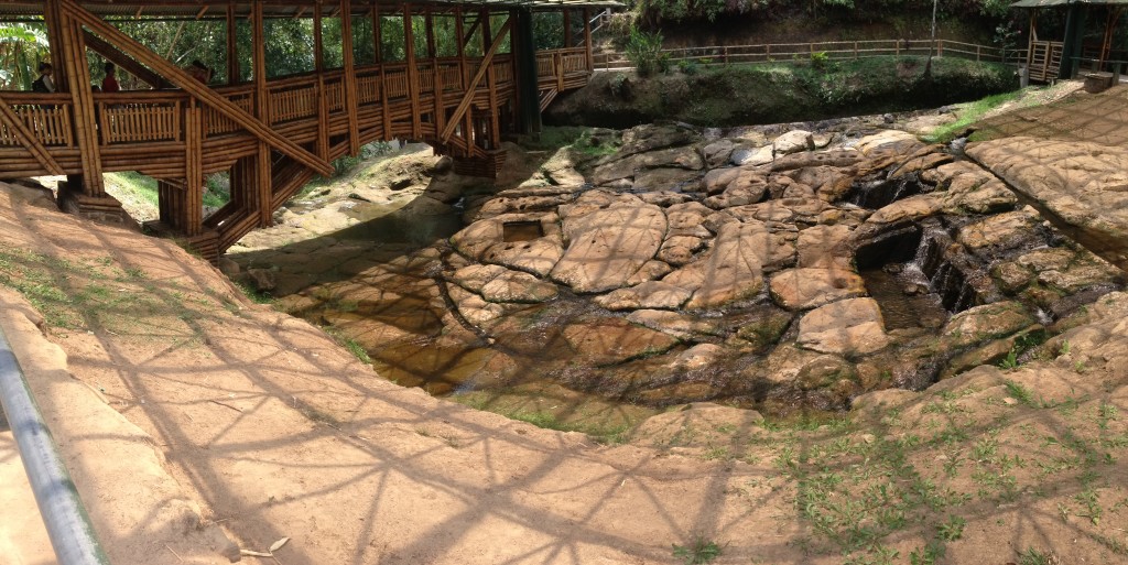
There are 11 archaeological sites in the San Agustin complex. This is one of them: Fuente de Lavapatas. Even if you’re getting tired, it is definitely worth a visit (the visit to the fuente is more interesting than Alto de Lavapatas, which is up a big hill) – if you’re deciding between the two.
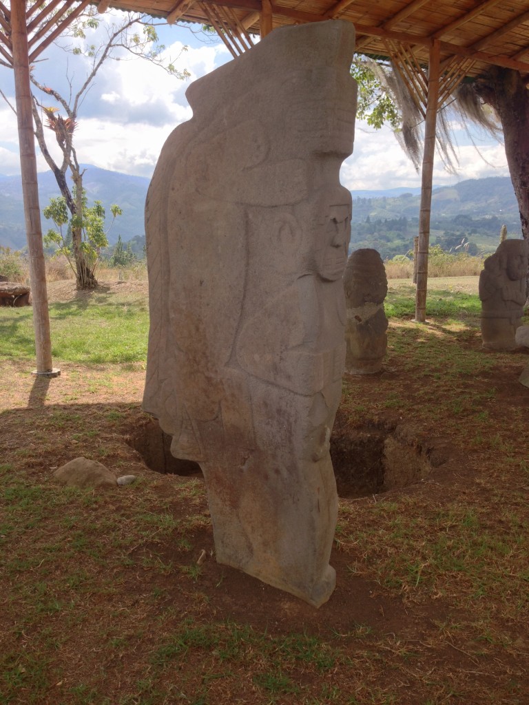
One of the “Doble Yo’s” seen at Alto de Lavapatas. Doble Yo means “double me.” – two guys on top of each other. I’m not sure what they are doing.
This is the map for the entire route discussed in this post. To Export GPX files, click on the three horizontal bars in the upper right hand corner of the map and select Export selected map data…
To see this map in a full screen, click here (opens in new window)


Reading this post is extremely entertaining and I am sure your FOMO was pacified. After reading then my FOMO has me getting out the maps and reading about the historical and geographical unique areas. Wonder how those Swiss guys are doing.