Bikepacking Peru – Huamachuco to Yungay via Pomabomba
The section after Huamachuco marks the beginning of my most anticipated portion of our tour of the Andes. This route takes you to a vista of the Cordillera Blanca before crossing one of the more iconic mountain passes in the world: Portachuelo Llanganuco. In my mind, this route delivered everything I dreamt.
A unique feature of this section is that it follows a very rarely (if ever) used route. We could find no documentation of it having ever been done before on a bicycle – nor could we find any GPS tracks to verify its feasibility. Moreover, locals in many locations told us that our proposed route was impossible or did not exist. Aside from the landslide section along the Rio Conchucos, I would expect that the entire route is rideable during the dry season. We did have to walk – a lot – but that was usually due to the mud left over from the transition between wet and dry season.
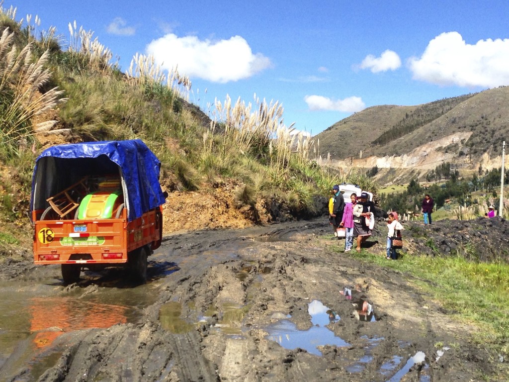
Leaving Huamachuco. The road is paved for about 10km, then you make a turn-off on the dirt here: 07.84738° S 78.10118° W Shortly afterward, you may encounter this – we were here at the beginning of the dry season, which lasts from May to September.
We knew that we were entering the mountains of Northern Peru a little early – just at the threshold of the rainy/dry season. With luck, though, the next two months of the Andes should be getting drier and drier. Even though the dry season is May through September, you can still get precipitation during these months.
Not long after leaving Huamachuco, you’re in remote territory with almost no one around. The riding along this section was superb. Although the route was dirt, it was well packed for smooth sailing.
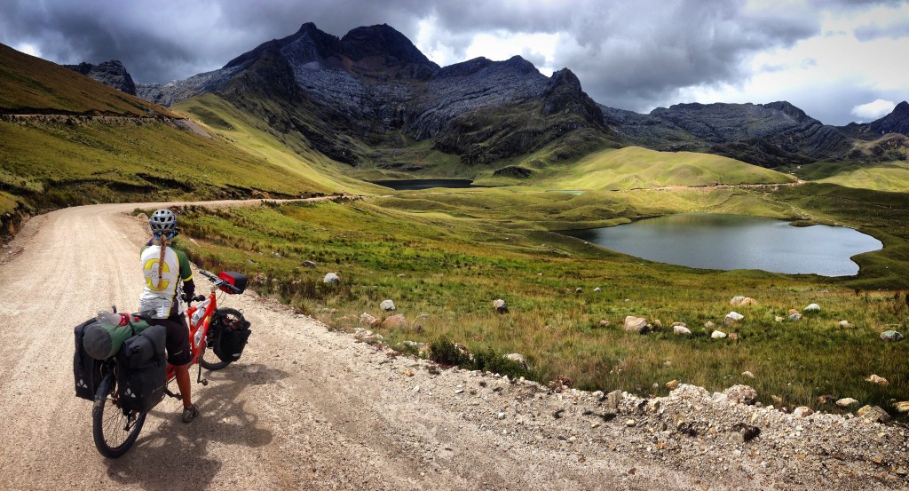
And then we got here! Picture taken from this location: 07.95130° S 78.03766° W. This is the scenery we came out here looking for!
Most touring cyclists will opt for the partly paved 3N highway from Huamachuco -> Quircucilca -> Santiago de Chuco -> Cachicadan -> Mollebamba. This may be a good route, though we don’t know much about it, and I haven’t seen any pictures that drew me in. The route that we suggest (see our GPS track) was scouted using satellite imagery. (**Our route was similar to that of Fat Bikers Dan and Gina, but they continued to Pelegatos where they were unfortunately robbed, whereas we headed towards Mollebamba. We were not aware of their blog at the time we by-chance made the decision to head towards Mollebamba. The route to Pelegatos -> Paragon -> Pampas looks like it might be more beautiful, but carries this risk.)
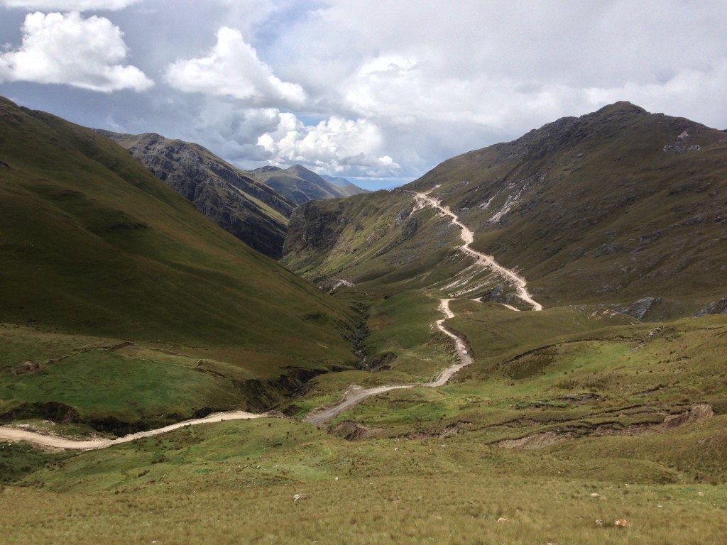
It is 40 miles along our route from Huamachuco to the next intersection. After we left the pavement, we only saw one motorcycle, and later some road construction workers who were repairing a backhoe. They told us that it was made in China, and that the heavy equipment made in the USA lasts forever.
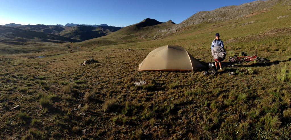
It is easy to find camping all along this route. There are no services, however, until you reach Mollebamba
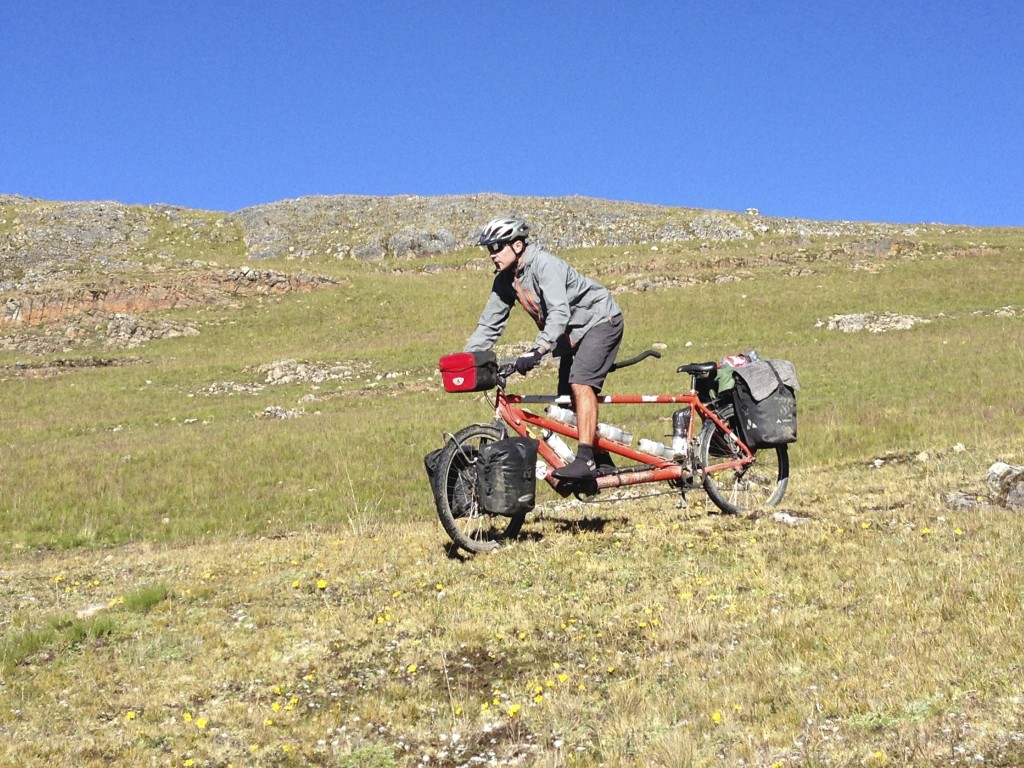
Free riding. The route down AN-101 to Mollebamba is only suitable on a full suspension mountain bike. We suffered heavily here, taking several hours to do a descent that should have taken a quarter of that time.
This route is pretty challenging – getting down to Mollebamba. A lot of the footage in the video below comes from this section, and the next section we will describe (after Conchucos):
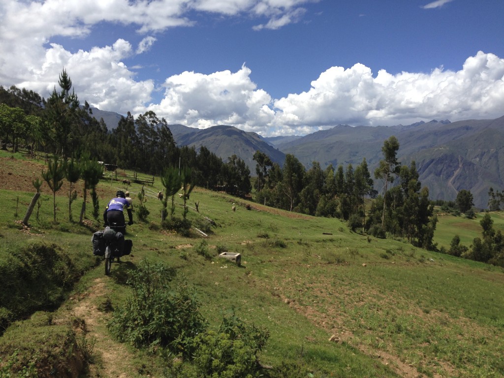
The lower half of the trail down to Mollebamba. As you get lower, the trails head in multiple directions, giving you several options.
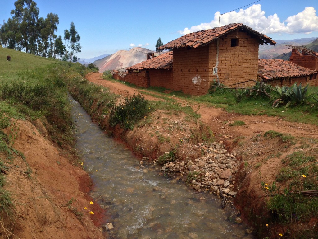
Mud and straw houses. Behind you can see a hillside that has been mined. For the next month, we’d see mostly houses with mud and straw construction.
Once you get to Mollebamba, there is a paved road that connects to Mollepata and the river down below. It is in good condition. In Mollepata, we ran into a food poisoning problem that could happen to you anywhere: We bought street food that happened to be cold at a town-wide party.
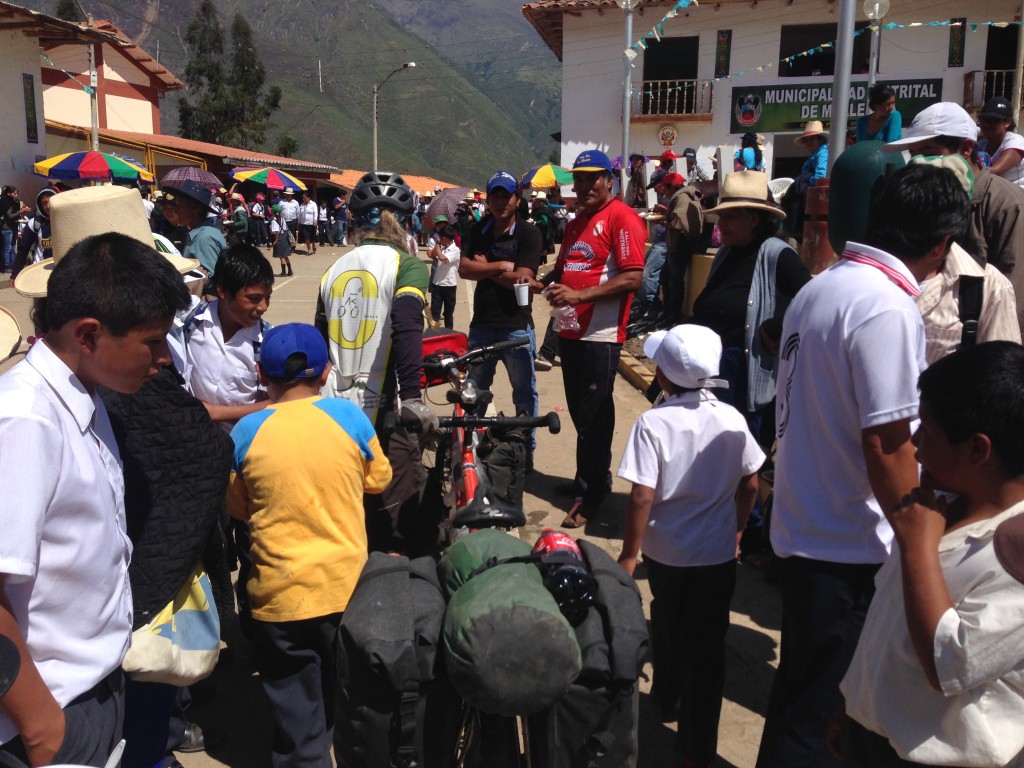
Mollepata’s 150 year celebration. When we arrived in Mollebamba above, the town seemed deserted. We wanted to buy food – but there was no store (open at least). Later, we figured that everyone had come down to Mollepata for this street fair. Unfortunately, we believe that this is where I got very sick. Janet had bought some street food: cold noodles and cold pork. I was concerned about the noodles being cold and refused to eat them. That left the pork. I don’t know what I was thinking and ate her piece too. On the plus side, only one of us got sick. We did not see any hotels here, but after following our route, our friends Scott and Sue found a hotel in Mollebamba.
… A few days later, I was very sick, barely able to ride. I managed to temporarily cure the ailment with Ciprofloxacin, but apparently my 7 day regimen was inadequate, and everything returned (worse) another couple days after I stopped taking the pills.
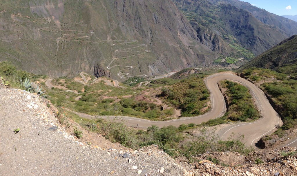
Descending from Mollepata to the Rio Tablachaca. In real life, it looks just like it does on the map – full of switchbacks. Almost all bike tourists head up the hillside you see across the valley (towards the Cañon del Pato). We wanted to do something different, and headed towards Conchucos. We could not find an internet account (nor a single pixel on the Strava heat map) of anyone having gone this way before.
We have no regrets about choosing the route through Conchucos as opposed to the Cañon del Pata. Although somewhat paved, the Cañon del Pata descends into the low and hot elevations – around 1,700′.
Due to the landslides heading up to Conchucos from the Rio Tablachaca, our route is the road less (or perhaps not) traveled. You can push a bicycle or maybe a motorcycle over the landslides, but there are no cars to bother you. Then, the last couple miles into Conchucos are amazingly paved!
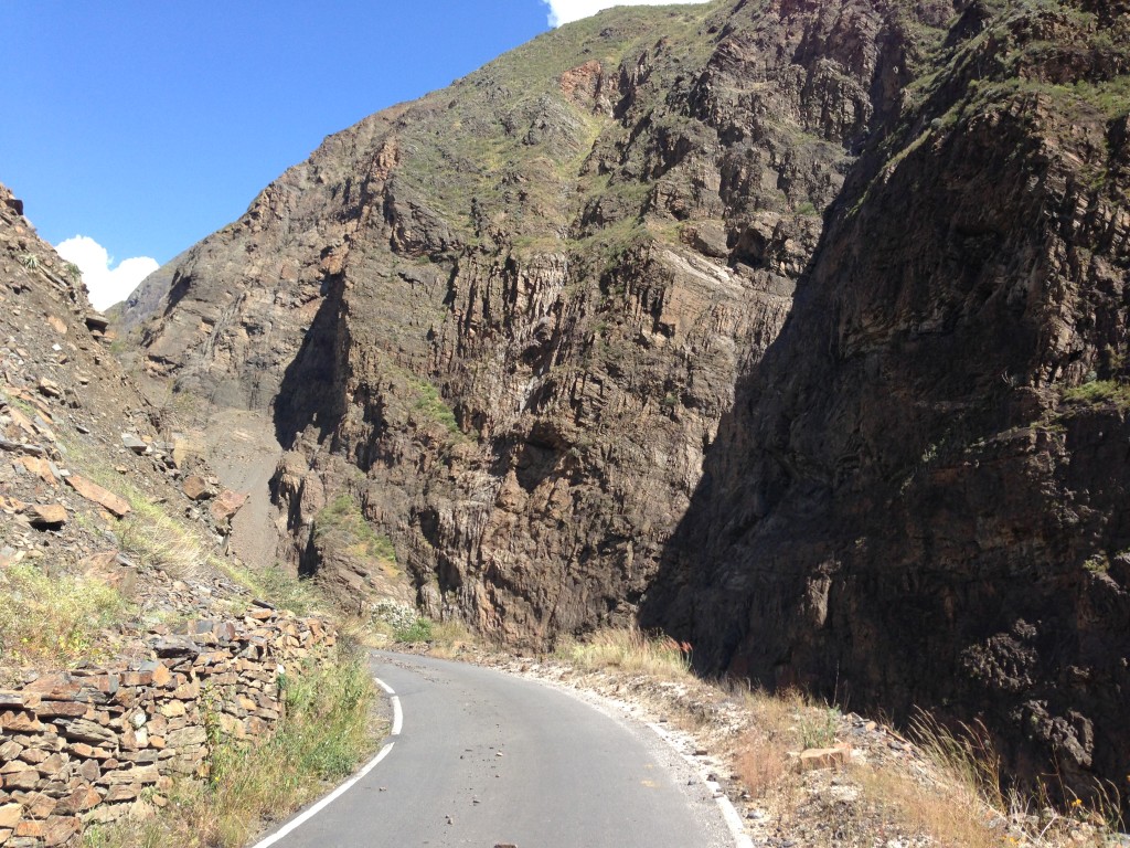
Heading towards Conchucos. The route is unpaved from the turn off of AN-506 all the way to here: 08.25433° S 77.88424° W. The route to Conchucos is covered with landslides. Apart from a sudden thunderstorm, flat tire, and chasing dog (all at once), we really enjoyed this section.
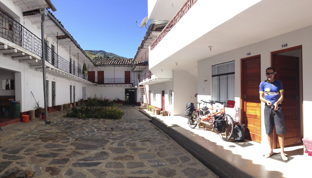
The last 3 miles into Conchucos are paved, and there are a few hotels there. The one we stayed at is located here: 08.26757° S 77.85331° W (the picture is of our hotel’s center).
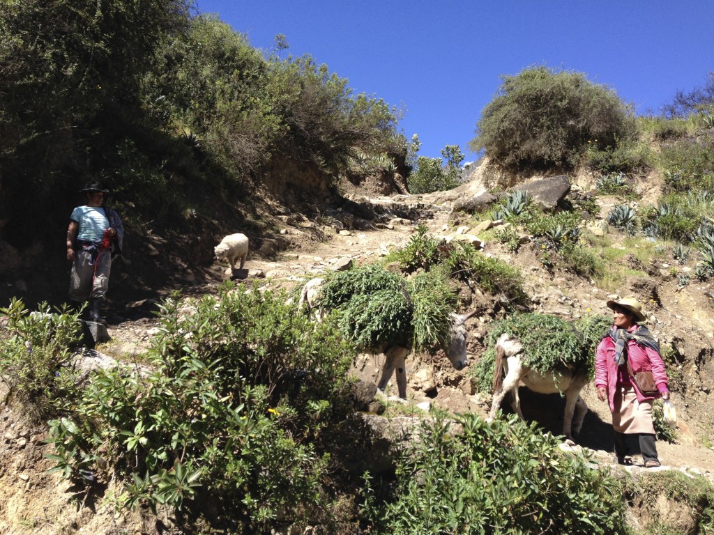
Leaving Conchucos, the route was beautiful – but we made a mistake and took this Inca trail. A woman scolded us for being so foolish, and encouraged us to head towards the “carretera.” We found the dirt road she spoke of. You can avoid this foolishness by turning left here: 08.27894° S 77.84775° W
After leaving Conchucos, you will have another lengthy section of at least 2 days with no services, so be prepared to wild camp. In better (non muddy) conditions, it may be able to be traversed more quickly.
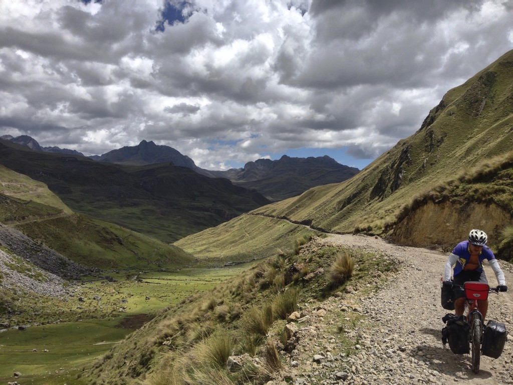
After Conchucos, you climb a steady grade towards (but not to) San Miguel. On this stretch, we did not see a single car (in fact, due to the mud, it may be impassible to vehicles as you will see below)…
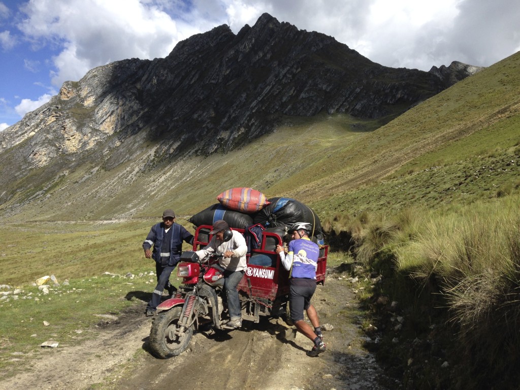
… but we did see one of these! Janet and I stopped to help this coca leaf chewing pair. We had been coming for several hours in the other direction. When I asked where they were going with this machine, I was flabbergasted that they wanted to get to Conchucos. This section was a muddy swamp for us, and almost certainly impassible for them considering the minor mud bog they were currently stuck in (with much more major mud bogs to come). We were here at the end of April – the transition from wet season to dry season. We recommend that if you follow our route, you come between May and September.
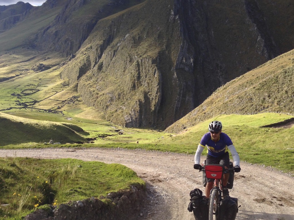
Climbing up out on AN-538 away from San Miguel (we didn’t head to San Miguel, so we cannot vouch for a resupply there. It’s a tiny establishment a few miles away from our route.
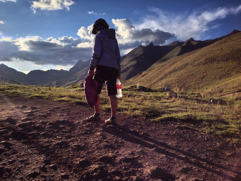
There is water available at 08.37746° S 77.68096° W which we filtered and treated with UV light (there are cows upstream). This was a good campsite – though there are many along this route given the isolation.
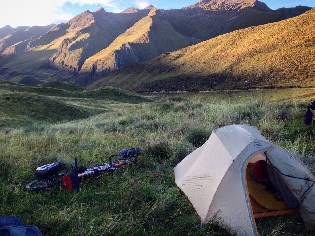
Our camp at 08.37856° S 77.68265° W
Finally, we had the moment we were anticipating: our first clear view of the entire Cordillera Blanca!
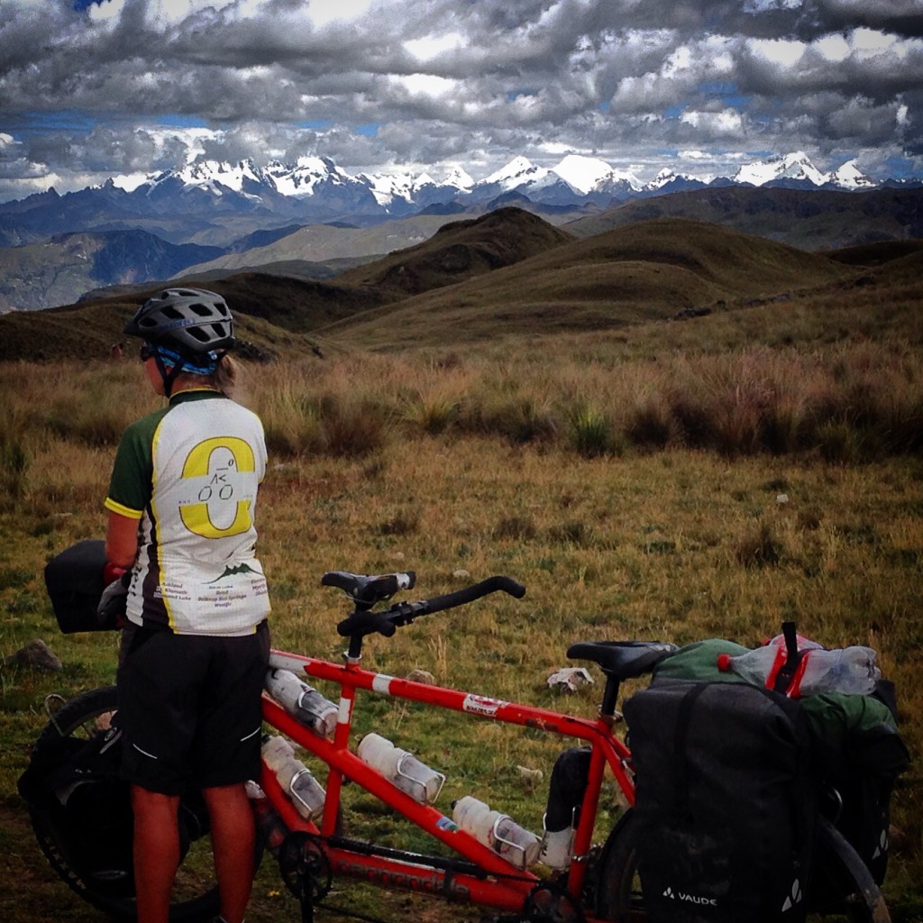
The first sighting of the Cordillera Blanca! Taken from here: 08.45020° S 77.69018° W This is why we were glad to have taken this route instead of the Cañon de Pata. We felt that there are other places where you can see tunnels and canyons very similar to Cañon de Pata (Such as Cañón de Uchco)… but there aren’t many places where you can see the full range like this. The picture here was with a regular iPhone camera, and shows about half of what you can see (there are just as many snow covered peaks to the right of this frame). I was wishing we had a decent camera at this point – but if you love the mountains like we do, you’re going to want to go this way.
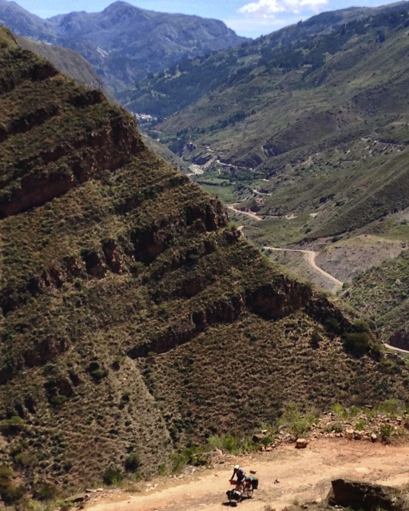
The climb out of Sihuas is dirt and very hot, but pleasantly graded. Here I wasn’t feeling too well as the effects of the Shigella I had consumed in Mollepata a few days early were beginning to show.
Sihuas isn’t a particularly pleasant town, but it has all the services you might need (except Wifi). Note that Sihuas is divided into two sections. We did find that our Movistar phone card had absolutely no data service (but plenty of phone service). Our Bitel phone card had phone and data service. This would generally be the case throughout Peru (and Bitel cards are cheaper too!)
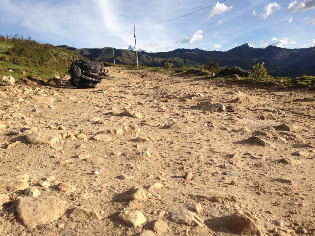
We really love riding the dirt – but if you can come with full suspension, you will be happier than we were!
Unfortunately, for me, this would be the first of two bouts of major sickness. We literally limped into Pomabomba – I was barely able to push the bike into town.
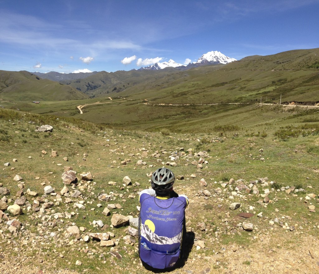
Taken from here: 08.70140° S 77.53675° W – just before descending to Pomabomba. This town has plenty of amenities: at least 4 hotels (the one we stayed at was superb and inexpensive, named El Merced (no wifi)). They also have an ATM, but in the several days we were there, it only had cash on the 2nd to last day. We were there several days so I could recover from my intestinal ailment. We also visited the hospital, but they were unable to help. Buying over the counter Cipro (and taking a double dose) was the ultimate solution.
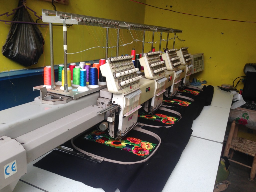
As in most of rural Latin America, most things you see are dirty and low tech. But hidden inside one of the market stalls, we found these machines blasting away in unison making intricate designs. I think you can guess what the priorities are!
Here is a story that will hopefully paint a picture of what it is like going to the hospital in Peru as well as make you laugh a little. I had plenty of time to write it; the last 4 days have been spent in bed.
4 days ago, after dragging ourselves the 19 miles into Pomabomba, Peru, I was elated to have the opportunity to purchase some Cipro. The last few days had been extremely difficult due to my illness, the terrain, and elevation.
Upon arrival, I went into the pharmacy and asked for some Cipro. The pharmacist said, “how many?” I asked, “how many for a full course,” and she said 14, so we went with that. I was back before Janet had even managed to buy a coke. In 2014, in Mexico, I confirmed that a doctor’s prescription is needed for antibiotics, but here the woman gave it to me quite willingly over the counter. I don’t necessarily propose that this is a good thing for global health, but at the time, it seemed like my life was being made quite easy. We were all smiles that day with our good fortune of making it into a town.
My ailment continued – in fact worsening over the next 4 days. I spent bouts of the night expunging liquids mostly green (which the internet taught me is the color of bile before it degrades into a more pleasant brown color).
This morning, we asked the kind owner of our hotel where to find a doctor. She said that the doctors now are all at the hospital, but in the afternoons, they “come down” to town. She advised me to go to the emergency room so I don’t have to wait behind loads of people. That sounded like a good idea – kind of like how it is at home.
Janet offered to accompany me, so we walked following the hotel lady’s directions. We walked past the ATM, where once again an early morning line of 30 or so indigenous women all wearing their costumes were waiting. Janet and I have tried to get money from the ATM each day after this line dissipates – only to find that it has run out of cash.
We continued to follow the directions as the route turned to dirt. I briefly questioned the directions, as this had been the route we had ridden the bike in on, and I didn’t remember seeing a hospital. I looked down towards the valley, but Janet went and asked some women chatting in the middle of the road if we were going the right way. I don’t think they spoke Spanish; she replied to us in Quechua – but she knew the word “hospital” and kept saying it as she directed us to follow her scurrying little legs. Even though she looked like she might have been 100 years old, she would have given Olympic speed walkers a good battle. We must have been too slow for her because as she edged ahead, she seemed to resume her previous itinerary instead of taking us to the hospital, which we shortly found.
I saw a sign saying “Emergencia,” and felt a moment of triumph. This hospital might actually function like the lady at the hotel said. We walked under the sign, and into a confusingly laid out building. There was no reception, so I asked around for “recepción” assuming that was close enough. Meanwhile, Janet had walked past rows of indigenous women, most of them with their babies lined up on benches in the dimly lit hallway, and found a window labeled “triage” (with that exact spelling).
At the triage window, they asked if I had insurance. I said no, so they told me to go to the cash register and pay first. The cash register is outside in the dirt parking lot, so I went there and answered the guys questions. I gave him my passport since I don’t have a Peru Identification Number. After I handed it to him, like many people in places we have traveled, he asked, “Que país?” (What country?) Never mind that this sentence doesn’t have a verb – I’m very accustomed to it now as people constantly ask us questions consisting solely of one noun. I mentally filled in the “are you from” that he left out… Usually, I restrain myself from being a smart-ass, but I said, “it says right there on my passport.” Without looking at my passport, he continued to look at me curiously, so I caved and said, “United States.” He seemed satisfied with this. Next, for the paperwork, he wanted to know my name, my mom’s name, and my dad’s name. Then asked my second last name, but then he smiled knowingly: “You Americans only have one last name, no?” I confirmed that this was the case. Next, I paid the 6 Soles for my doctor visit ($1.87), and took my receipt back to triage.
At triage, they told me “not yet…” now I need to go to “Admición”. I walked across the narrow hall, carefully avoiding the broken/missing tiles on the floor, and at that window, they needed my Peruvian ID number once again. Then, there was some confusion about my name on the receipt from the cash register window. “What is your second last name?” – you need that! A guy in the background gently reminded him that Americans don’t have a second last name before I started the explanation. This was enough, and they accepted my passport number in lieu of the Peru ID. They made me a neat blue folder – my medical record – that matched the many on shelves of medical records in the back, and I took that and my payment receipt all to triage. They said, “we will call you when we’re ready.”
I sat down on a humble bench next to Janet as a guy came up to us with a bucket wanting to sell us cheese. He said, “cheese?” We said no, as I rolled my eyes internally about people in Latin America choosing to exclude verbs from their sentences. Another woman walked by with several clear plastic cups containing watery food-colored gelatin for sale. The cheese man went about seeking other customers in the dark hallway, and shook hands friendly with the Admición guy.
“Michelle!” I heard being called. Since it hadn’t been too long, I hadn’t tuned out yet, and I realized that this was probably me. My middle name is Michael. I went over to triage, and the stern lady that looked like a 4 foot nun with thick rimmed glasses and a strong lens prescription that magnified her sunken and over mascaraed eyes. “How tall are you?” she barked. It took me a second to process the word “tallas,” briefly thinking she was asking “what size are you?” My pause was long enough for her to bark it again, and for the other patient in the room to start giggling. Actually, I don’t know my height in meters, so I paused again – vaguely thinking I could get a calculator, finally coming up with a lame, “is this necessary?” She shoved me backwards a couple feet – they had a measuring tape on the wall. The man who had been taking the blood pressure of the giggling woman came by and forcefully pressed on my face so my head would be against the wall, and they placed some wooden block thing on top of my head after grabbing the sunglasses out of my hair.
“How much do you weigh,” she asked. Having seen the scale right next to the measuring tape, I said, “can I use the scale?” She obliged, and barked something out that I didn’t understand while pointing at my feet. I assumed she wanted me to take off my shoes. I began to untie them, but that was wrong. I never found out what that command was, because next we both found that I was 70Kg after she worked the balance mechanism.
Taking my blood pressure and heart rate was not too much different from a non-mechanized version at home. She scribbled all these numbers in a notebook made from that same kind of flimsy brown paper our notebooks were made of in the ’80s. Then she grabbed a calculator and did some math with my height and weight. Normally, I’m “overweight” in the BMI (body mass index), but she reported that “Everything is normal, except your height.” If this was a joke, she didn’t smile. But for here, it’s true. While I’m so short in Norway that my legs are barely long enough to make the urinal work properly, here I can see over the heads of a sea of people at a concert.
I sat back down with Janet who was reading “George the cyclist’s” blog on what looked like a school bench from some US Catholic school in the 60’s. You know you love bike touring when you’re in the middle of a 6 month bike tour, and all of your reading material is other peoples’ bike tour stories. We often read these blogs to each other in the tent, and we sometimes (in the case of when the authors are traveling in Uganda or Mongolia) revel about how our bike tour is somewhat less challenging than those of our entertainment.
This is where the waiting began. From the bench, I took note that almost everyone here was female. Janet joked that the men had better things to do. I watched as a stray dog wandered down the hallway, looking for food.
I was called last – dangerously close to the lunch siesta time – about three hours after arrival. I don’t begrudge the long wait; I assume that my issue was less severe and/or we had arrived later than the others.
The doctor seemed quite intelligent and well informed. He asked what my second last name was… Anyway, I had made a detailed calendar of the progression of symptoms, and the response to my self-medication (and the Cipro dosage intervals). We discussed all the particulars, and the difference between bacteria, parasites, and viruses. I was still assuming this was bacterial, so I asked him if he had encountered pathogenic strains of bacteria that were resistant to Cipro. He said that in Peru, only in the coast. In the mountains, Cipro should work on all strains of bacteria that could be potential infectious agents. Therefore, we decided to do a lab test for parasites. He explained that this isn’t a very technical hospital, so they can only do a microscopy test – looking for eggs or the actual cells of parasites such as amoeba or Giardia. I confirmed the Typhoid oral prophylaxis that we had taken prior to the trip. Conversation was easy, as science and biological terms in Spanish hardly differ from their English counterparts. A lab exam was ordered.
I went the 6 feet back across the hall to the lab, but she said I needed to pay. I went back out to the parking lot and paid 10 soles ($3.05). Took my receipt back to the lab tech, and she handed me a small clear plastic jar, thankfully with a lid. Why the hell are these containers always clear? After asking for some slightly embarrassing help finding the bathroom (given what I was about to do), it was revealed that the bathroom was right on the other side of the 6 foot wide hall. The few wrinkled indigenous women remaining stared at my cup (or so I thought), so I stashed it in my pocket and went into the small room.
I had been dreading this part – and it was looking like it would be worse than I had imagined. No toilet paper, no toilet seat, and no soap. Hmm, no soap in a hospital? Great. So I tried a few manners of positioning, finally conceding to resting my body weight on the seatless toilet. The whole porcelain construction heaved and splashed – apparently it was not bolted down! Rebalancing myself, I focused on the task, carefully releasing a Hershey squirt that I had been saving all morning for this purpose. Upon inspection, I had miraculously delivered it expertly into the small cup with nary a splash. Feeling proud, and unsure of the required quantity, I released another dosage of the juice with no problem.
Even thought the jar had a lid, I restrained myself from pocketing it upon exit, hoping that the staring women wouldn’t notice as I walked across the hall, and hand delivered the now warm container to the young and nice looking lady who would soon be examining it under a microscope.
A few moments later, the lab tech called out about my sample, “Michelle, what is your second last name?!”
Anyway, it turns out that there is no inflammation, no blood, no mucus, no eggs, and no parasites in that swampy mire I handed them. We all know that there’s something in there, but the doctor doesn’t know what. After I went and found the doctor to review the results, he and I talked some more and said that it is really strange. Never heard of these symptoms before that also don’t respond to Cipro. So, I left the hospital with a prescription for electrolytes.
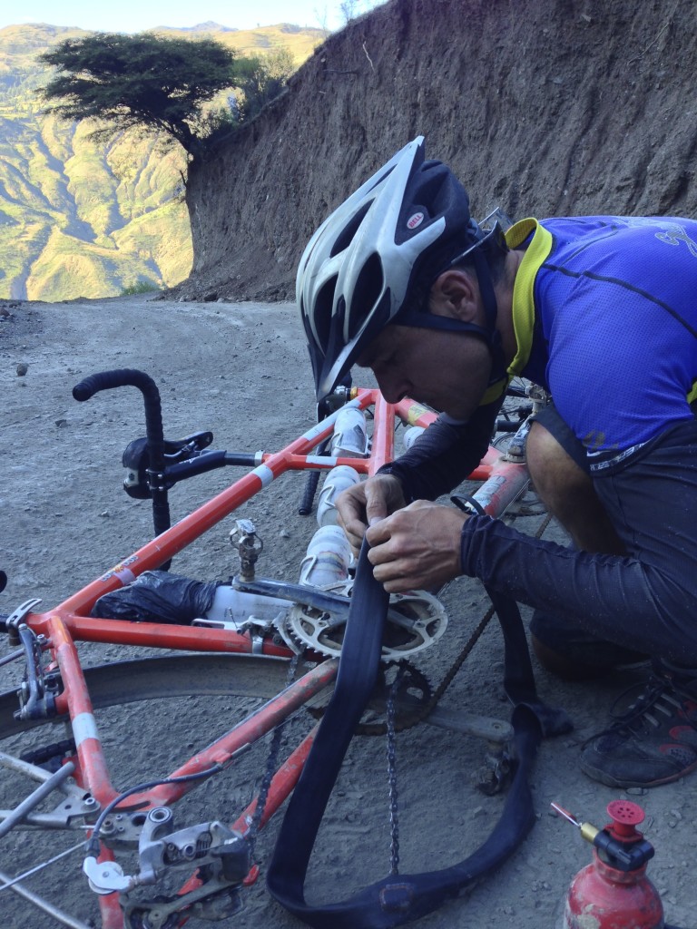
Thumbs Up Brand Patches… a big Thumbs DOWN! I bought a 48 pack of Thumbs Up Brand Patches – only to find that they do not work! They adhere successfully to the tube like Rema Brand patches – but they do not have the strength, and the air bursts through them in short order. Here I am conducting several experiments (none were successful). In one experiment, I tried to put about 10 of the bad patches on top of each other. This did not work at all. In the 2nd experiment, I tried to make a patch from an inner tube. Unfortunately, I accidentally cut open the last “good” inner tube (i.e. tube with smallest hole)! I applied vulcanizing fluid to both the tube and the patch made from the tube (having cleaned both surfaces with fuel from our stove). This did not adhere. We limped into town on a low pressure tube.
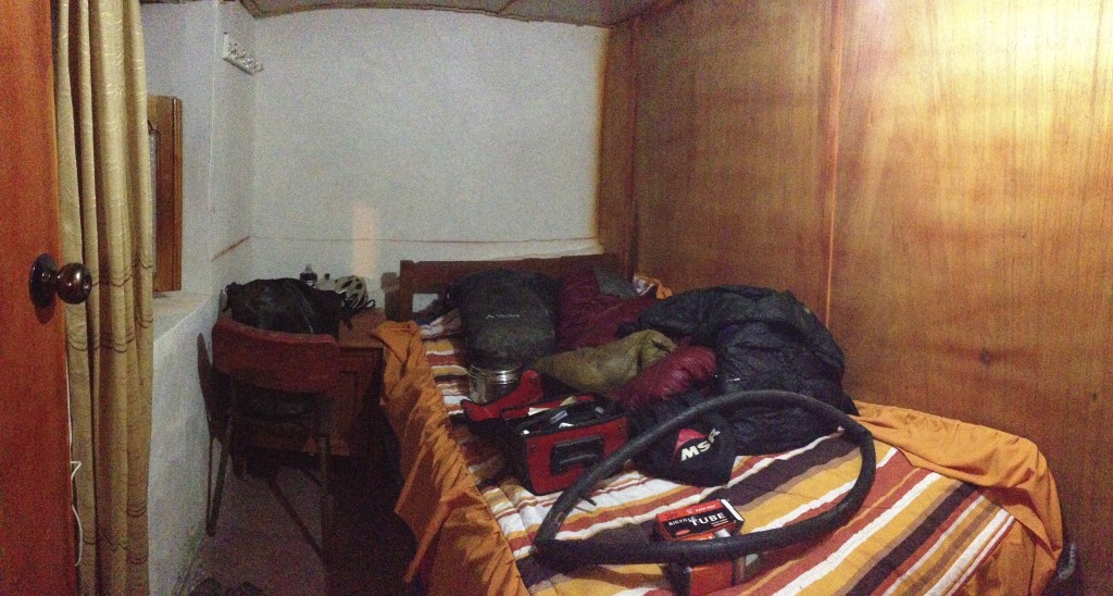
My “hotel” room in Llumpa. Our presence was of great interest in this town with crowds gathering around us. People were quite friendly and inquisitive – probably because very few cycle tourists take this route. I think that if you’re on this side of the mountain, people might be more likely to take the route through Piscobamba. There didn’t seem to be any signed hotels here, but a woman and her friendly son rent out 3 (essentially one person) rooms at this location: 08.96107° S 77.36774° W Janet got her own room next door. They were 15 soles each – so if you are willing to cram into one room, you could save some money. Shower was down some rickety wooden stairs, and I took a military shower (and still used up all of the water mid shower).
I doubt that this route has been traveled much by cyclists, so if you’re looking for a lot of attention, take the dirt road towards Llumpa! We received very kind treatment from the few residents in this tiny village. It was a little overwhelming to have to answer so many questions, but the people here did their best to make us feel welcome.
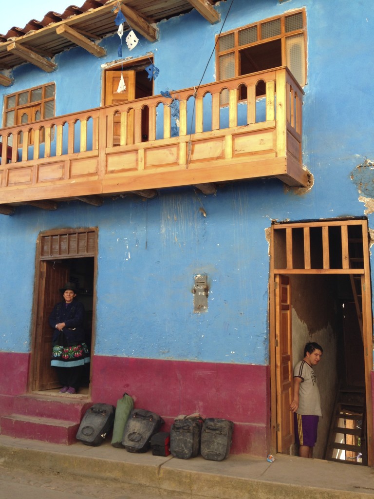
This is where we stayed at 08.96107° S 77.36774° W. We heard there is another hotel in town, but did not look for it. This village is very small, but we were still able to buy two inner tubes at the “hardware store.” In fact, on the West end of town, there is even a building with bicycle shop painted on the outside!
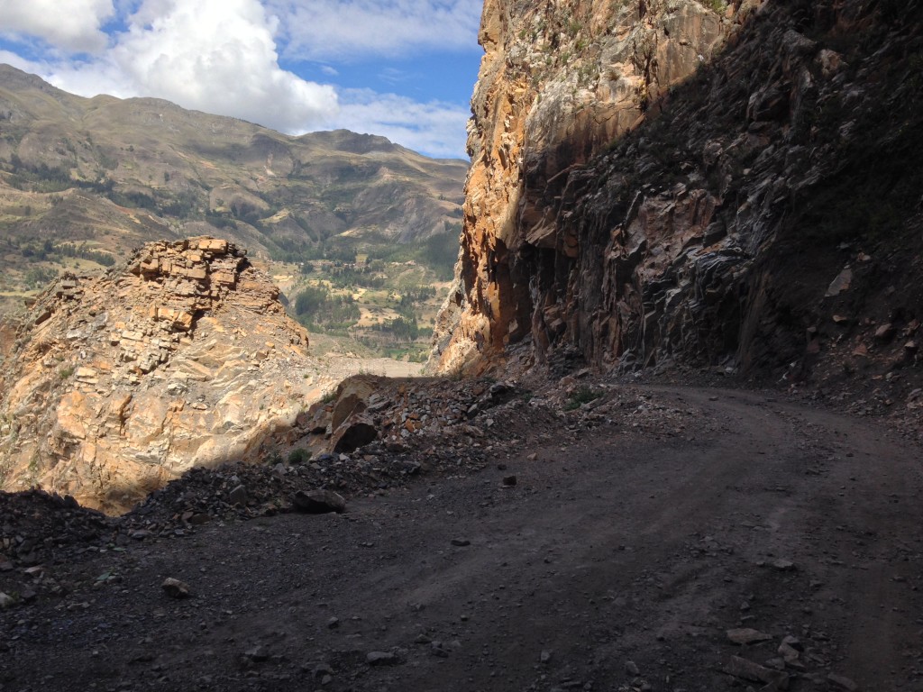
Leaving Llumpa, we continued along the contour. All the locals recommended this instead of descending to the river along AN-105 to AN-106. After we rounded the bend, we could see that our route had less climbing. The road was somewhat rugged, but I’d expect that the road down the canyon would be about the same.
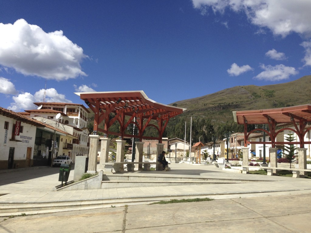
When you finally reach Yanama, you’ll be back on the road “slightly more traveled.” Yanama has a nice town center as pictured here.
The route from Yanama to Yungay was one that I had been really looking forward to – and it did NOT disappoint!
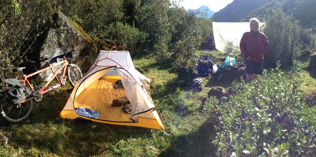
Our campsite at 09.02595° S 77.54331° W. There is a region of good secluded camping along the South side of the road in this section. There may also be good camping near the lake a few switchbacks above.
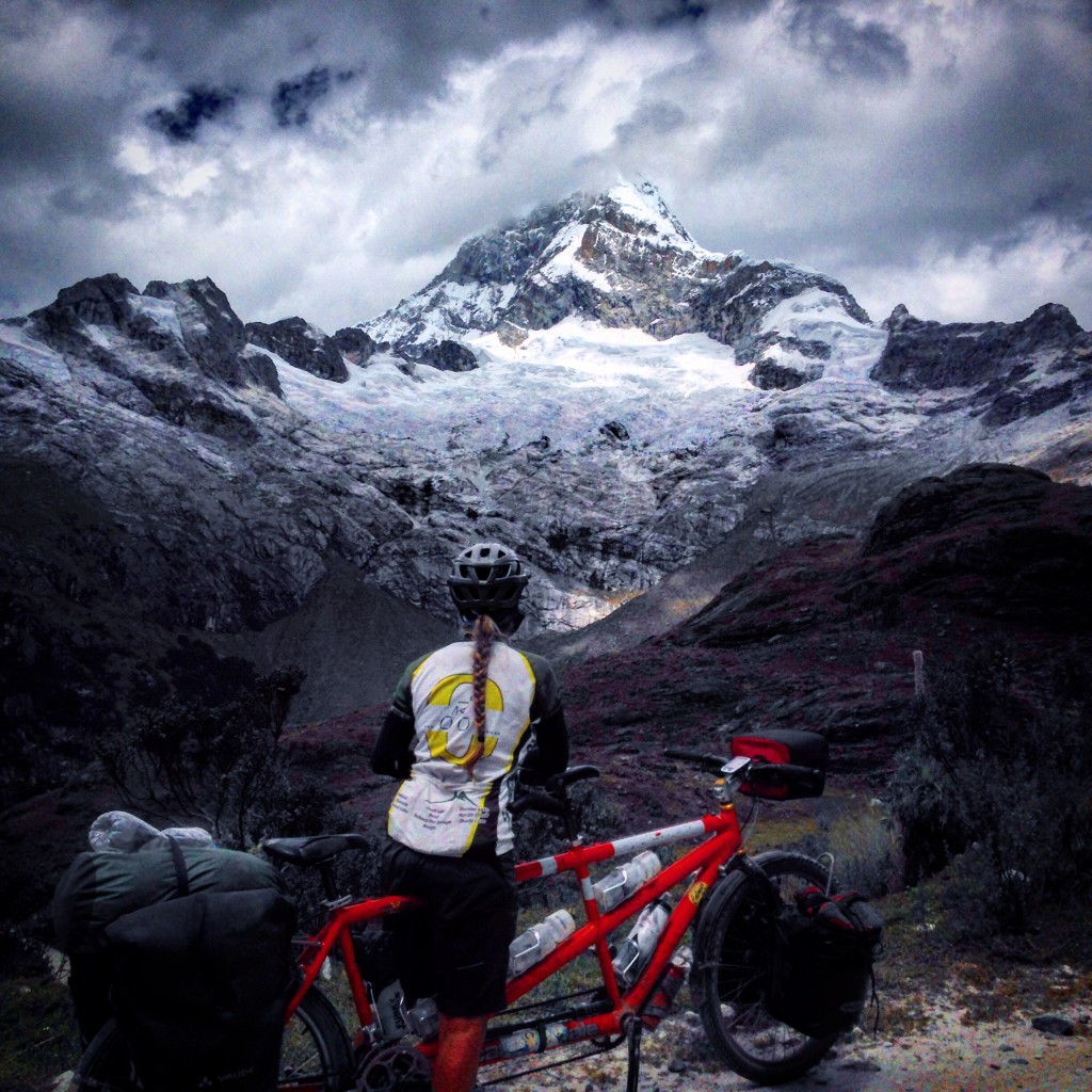
Janet looks on Chopicalqui (6354m). This peak is omnipresent as you ascend towards Portachuelo Llanganuco (the pass between Yanama and Yungay).

This is the sight that greets you as you come through Portachuelo Llanganuco from the East. We were floored.
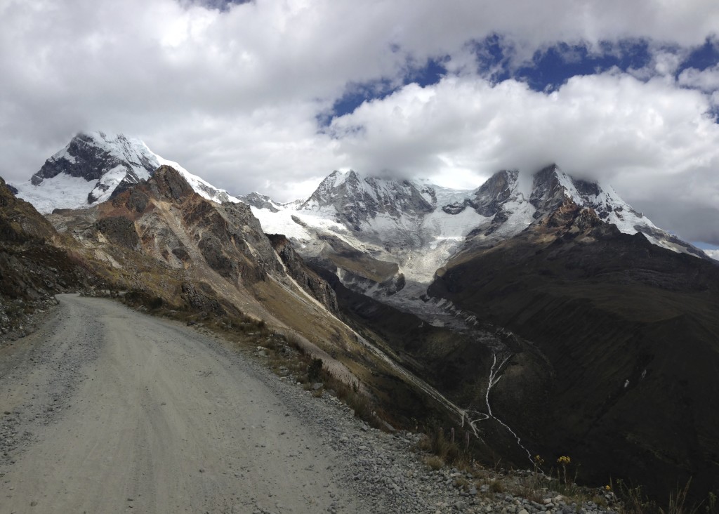
From left to right you can see Chopicalqui (6354m), Huascaran Sur (6768m), and Huascaran Norte (6652m).
This is the map for the entire route discussed in this post. To Export GPX files, click on the three horizontal bars in the upper right hand corner of the map and select Export selected map data…
To see this map in a full screen, click here (opens in new window)


Enjoyed the hospital story! Tedious being ill in these places.
What camera are you using for the photos?
I notice that you don’t have the map with your gpxs on the home page anymore, is that deliberate? I don’t need it, just thought I’d mention it.
Hi Nick –
Yeah, no kidding about being ill – I just found out that I have diabetes type 1 now, but it may have been accelerated by this illness and the antibiotics (3 courses). Just using an iPhone for those photos. Bought a Sony RX100 as soon as I got home because I wish we could have taken better pictures. Yes, I removed the map from the home page. It was a “moving map,” but now that we’re home, it has been delegated to the South America Main Page (which I hope to finish some day): http://www.brianlucido.com/bike-touring-south-america/
Thank you Brian for sharing your beautiful Blog. What beautiful photos, in a beautiful area.
Thank you Brian for posting such a great Blog with such beautiful photos. What a beautiful area. Sorry to hear of your long illness. Geez! Thanks for sharing your beautiful Blog.