Highway 108 and Highway 4 Mountain Biking
This post introduces two spectacular mountain bike loops on national forest land. It also catalogs a few other great rides near Highway 4.
09/05/2009 Riding Near Utica Reservoir (short route) – 5 miles, 375′ of climbing
This is a short ride that is easily accessed from the Sandy Flat Campground at Utica Reservoir. There are other campgrounds near the reservoir such as Rocky Point Campground, Union West Campground, and Union East Campground. All of these were fairly quiet in September, but they would probably be busy during high season. This route takes you through some technically challenging terrain, and is pretty fun, in spite of its short length. It’s a good route to do if you arrive in the afternoon and don’t have time for a full ride.
09/06/2009 Utica-Union-Lake Alpine MTB loop – 19miles, 2,100′ of climbing
This is a 19 mile loop that is mostly single track. The part that is fire road still keeps your interest because it is very technical fire road. The riding is good quality, and challenging. A good place to start is the Sandy Flat Campground at Utica Reservoir, but you could also start at Lake Alpine on HWY 4 as well.
09/09/2009 Lake Alpine Bee Gulch Trail Figure 8 – 14 miles; 2500′ of climbing.
This route includes a pretty good mountain bike trail: the Bee Gulch Trail. The Bee Gulch trail is good, but it is short. Plus, the climb to reach it is challenging. For us, we felt the ride was going to be too short, so we added on some trails on the West side of Lake Alpine first. We started from the Lake Alpine Campground and did some of the nearby trails first – but you could head straight up and do the Bee Gulch Trail first. See our map/GPS track at the link above.
09/11/2009 Eagle Meadow MTB Loop – Eagle Creek Trail 21 miles; 2,700′ climbing <- Top Quality Route!
This is a near perfect loop! We started from the Brightman Flat campground (which is a nice campsite). From here, we headed “down” Highway 108 towards Donnell Lake (even though you’re heading back towards the valley, it’s a climb, which is why I put “down” in quotes) You turn off on Forest Route 6N24, and in about 1/4 mile you make a right on Forest Route 5N04. In another 1/2 mile, you turn right on Forest Route 5N01. Keep climbing this until it drops down to Eagle Meadows – a good place to take a break before you get to enjoy a fantastic single track descent to your camp. The route is challenging, but very fun; definitely not as difficult as the next route.
09/12/2009 Pinecrest Peak Trail MTB Loop <- Top Quality Route!
If you liked the Eagle Creek Route above, you will probably love the Pinecrest Peak Trail loop (PCP). Be warned, though, that the lower portion is very technical. I found that my Bullet was a superior bike for this trail when compared to the cross-country blur. One thing about this route that is *VERY IMPORTANT* – Please do not race down this trail. Also, please be extremely courteous with anyone you meet: hikers, horses. As you are descending this trail, you are the lowest priority in terms of right-of-way. In other words, that means you politely yield to everyone. Please, please follow this courtesy so that this trail can remain open to be enjoyed by others. It is a fantastic route, and we need to work together to keep it that way.

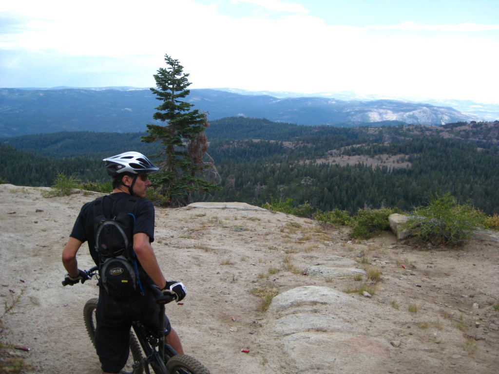
At the top of the Pinecrest Peak Trail, shortly after passing Herring Creek. Get ready for an amazing, technical descent! We observed youths target shooting across the fire road here. You will probably hear the noise before you cross their path, but please be careful
Other smaller, less interesting routes:
This Route encompasses the legal bike riding trails near the Bear Mountain ski resort. None of them were that spectacular for mountain bike riding; mostly fire roads, with a few single tracks near the top.
09/08/2009 Running around Lake Alpine HWY 4 – 8 miles, 800′ of climbing
On a September morning, running on HWY 4 is not a problem. I ran up the highway, and then back on good quality trails. The link above takes you to the route map.


